
Hotel Galavnis Kari
Hotel
Cheremi historic site (the ruined/former city of Cheremi) is located in the central part of Gombori ridge, in the area of the village Cheremi and on the rocky hill to the west, on the left high bank of the river Chermiskhevi. Historical sources provide significant information about the localization of the city of Chermi, the chronology, the establishment of an ecclesiastical cathedral, the Persian expedition, and its route. Historical information was significantly expanded by the reports of Kakheti Archaeological Expedition arranged for ten years from 1970.
Archaeological expedition around the village and to the east of the village, on the hill of so-called Tsverodabli, has proved the existence of numerous settlements and burials of the Late Bronze-Iron Age. In the same area, there are also monuments of the first half of the 1st millennium BC. In the present-day rural area and on the hill of Tsverodabli, where the existence of Chermi districts of the Gorgasali city has been confirmed, important urban-type settlements and cemeteries of the III-IV centuries have been identified and studied. The material discovered at the cemetery: glass-ware, numerous beads, various jewelry, and coins indicates the existence of an important trade route connecting the East. This is this path that Juansher (Georgian historian) must refer to when describing the route of the Persian army. It was this road that contributed to the rise and settlement of the Cheremi and other points on this road (Khornabuji, Velistsikhe, Ujarma).
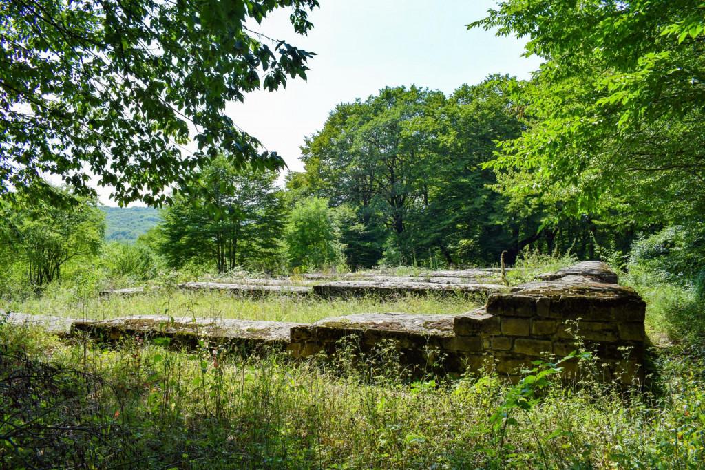
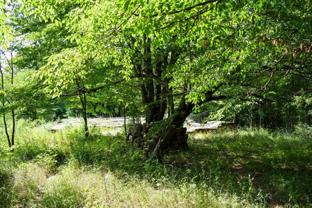
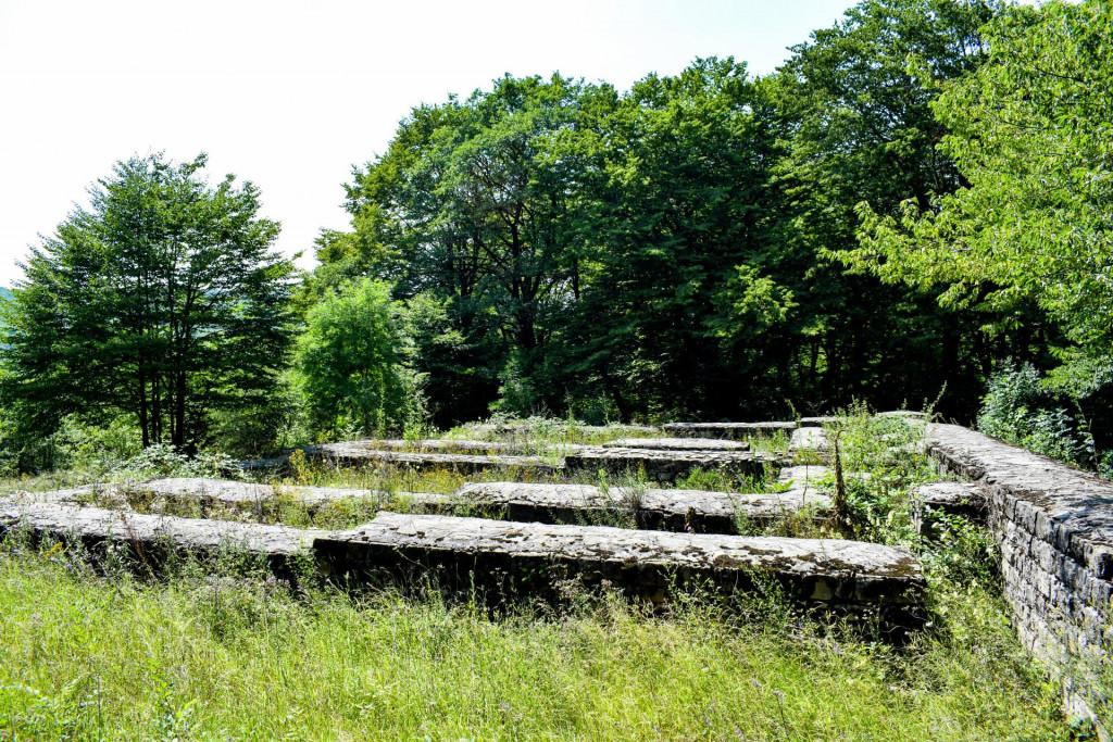
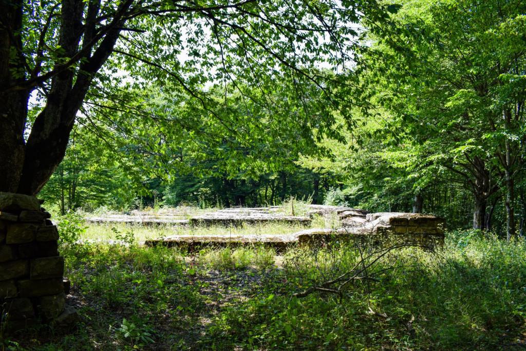
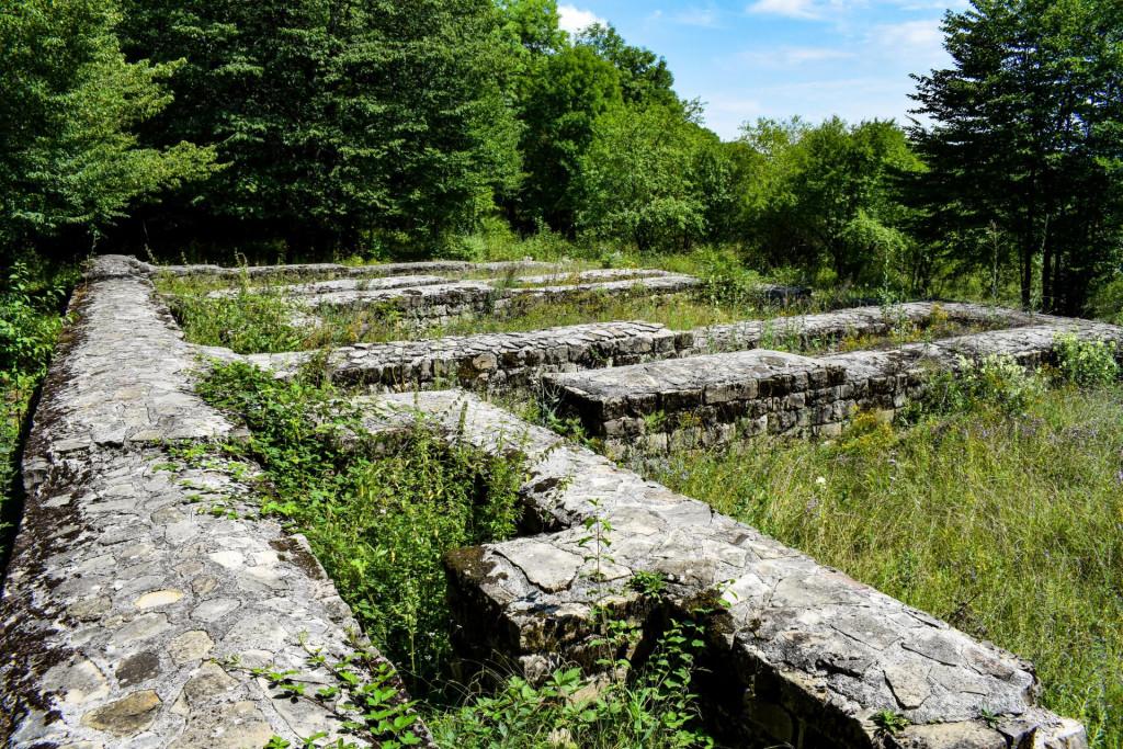
According to archeological research, in the 5th century the city of Cheremi, like other cities of the 3rd-4th centuries, consisted of several districts separated from each other. Each district had its own church. From many districts of the town of Cheremi, only the Gorgasali citadel which is located 4-5 km west of the present village, on the so-called Tsverodabali hill, had the protective wall.
There is also a stone-paved path. The castle-hall mainly consists of two wings, which are connected to each other at right angles. The compartments in both wings are arranged in one row. In the middle of the eastern wing is a narrow corridor with two storerooms on either side. On the north wing, there are two storehouses and one corridor. The storerooms are connected to each other by one door. In addition, each of them is connected to the yard. The north wing of the castle-hall is built in an even place, while the east wing runs to the south. For this reason, in the threshold of the doors connecting the east wing storerooms, one step is extracted. The east wing is joined at an obtuse angle from the south by a large rectangular tower with an entrance from the courtyard.
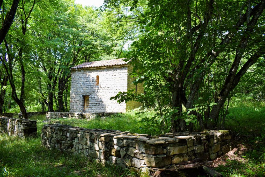
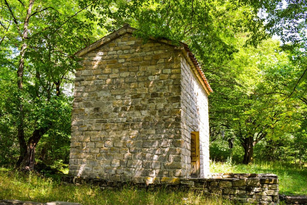
Sixty meters east of the palace is situated St. Barbara Church, it is built with the same set and materials as the castle-hall and the palace itself. N. Chubinashvili considers it a monument of the last third of the 5th century. It is a hall Church with dimensions 6.8 m * at 4.3 m.
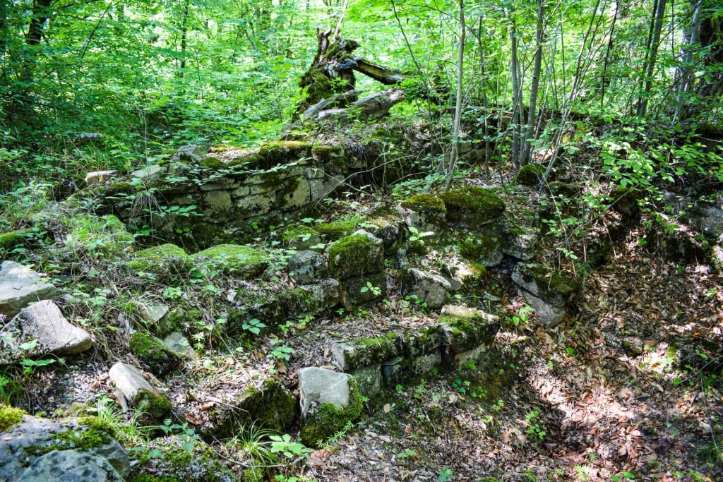
In the middle ages, a monastery was located in the citadel of Cherma. Remains of the monastery's agricultural buildings have been found on the ruins of Vakhtang Gorgasali Palace. Among them is a farmyard enclosed by a circular fence, built of large stone slabs, in the western part of which there is a whole complex of residential buildings - a cellar and a storeroom with shelves separated by a narrow paved road, to the west and south of which there are other storehouses, and to the north - a two-story cellar.
The cellar has a square shape, with an entrance from the south. In the western and northern walls, wineries with a thick layer of lime mortar are built. In front of them are also shelves along the entire length. The western wine cellar and shelf are better preserved. In the middle of the shelf is a takhcha (open cupboard built into limestone wall), in it was placed a vessel in which was poured sweet liquid from a wine pipe through a clay pipe. Then the sweet liquid was poured into a pitcher placed with this dish. There are three pitchers preserved in the cellar, to the south of the cellar, across the paved road, there is a storage pit for agricultural purposes. The west wall has a shelf along its entire length. In the north, there are two pear-shaped pits paved with stones. The north-east corner of the building is also paved with stone - as well as the pit from the outside to the east corner. The west area of the farmyard was also used for agricultural purposes. A stone-covered grain storage pit, large pitchers, a pantry, and more were discovered here. On the hill of Tsverodabali, to the south of St. George's Church, are the ruins of stone buildings, which may be the remains of monks' dwellings and the tombstones covered with stone slabs found near St. Barbara Church - their graves.
Our guides are ready to help you on this trip

Buy our tours online and explore incredible Georgia!

Help other travelers use your experience.
Review this destination, share your thoughts, impressions, pros and cons.
Let's make traveling easier than ever.


Please login to ask a question
Ask a Question