
Lower Sharakhevi
Village
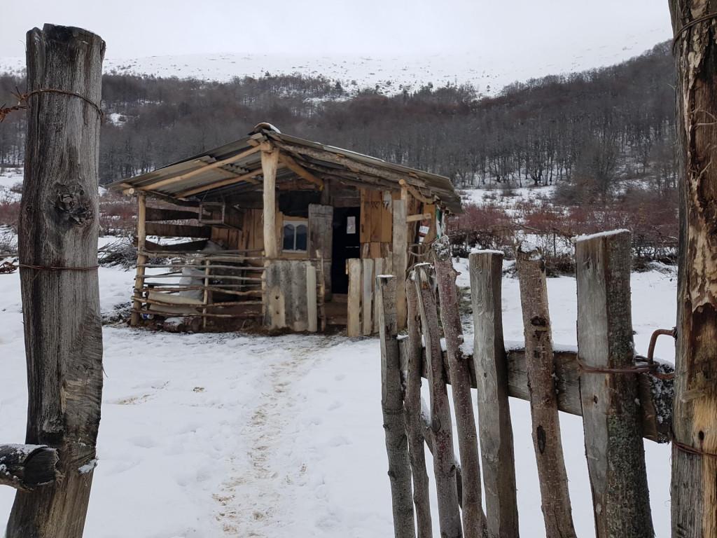
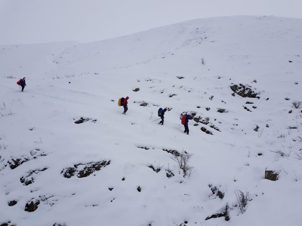
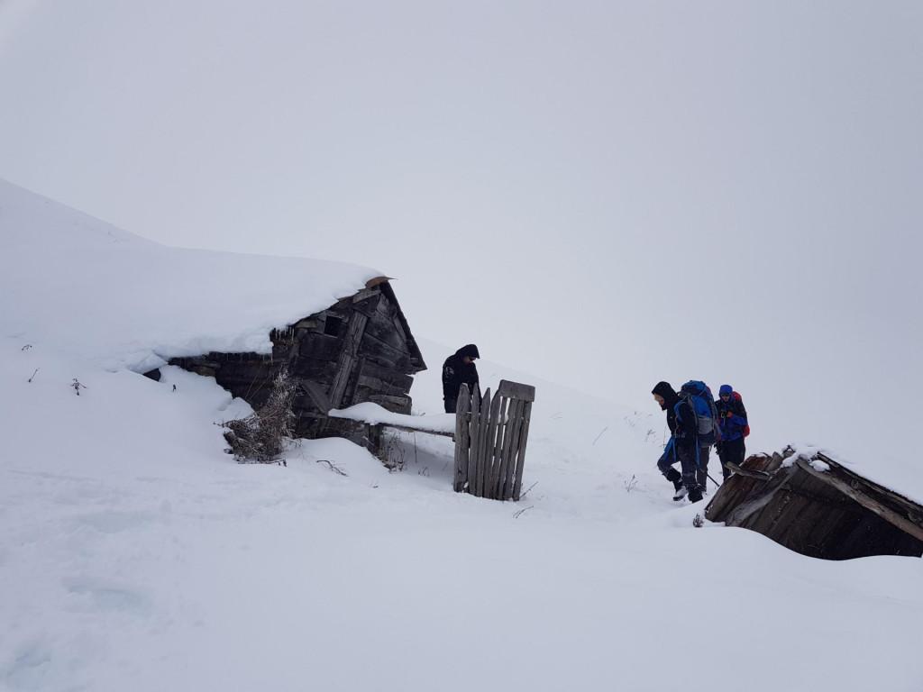
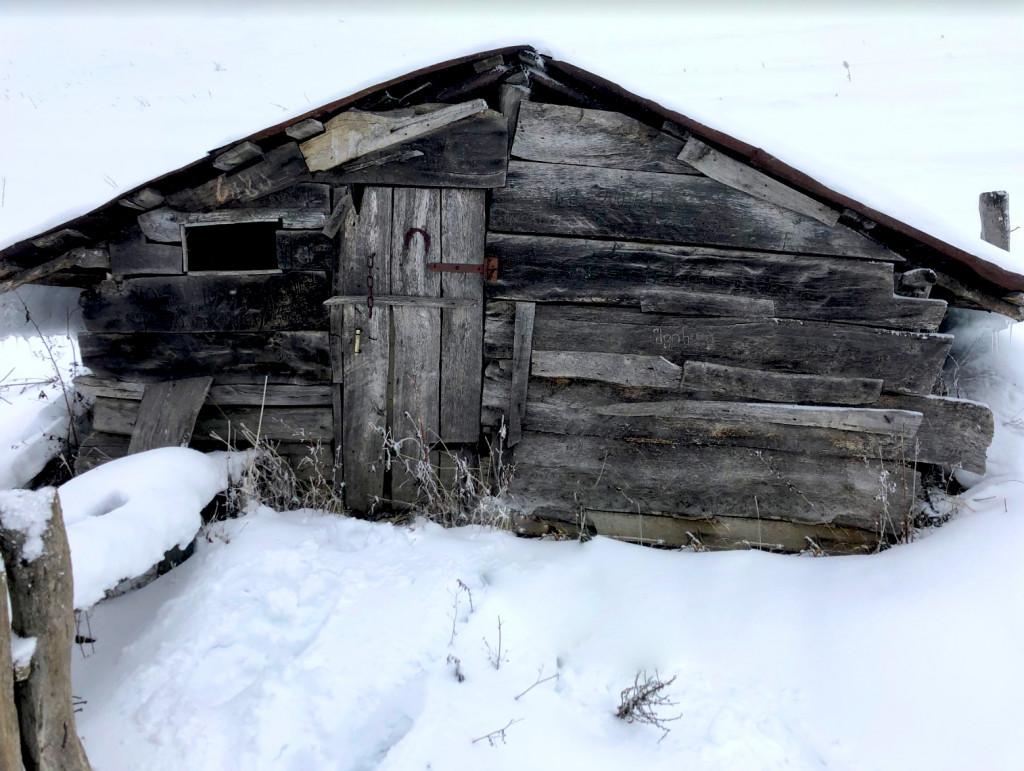
The trail starts next to the river Aragvi, in the lower Sharakhevi gorge 850 MSL. From the river Aragvi the trail follows the ground road up to village Kvemo Sharakhevi 3.5 km. From the village, the trail is directed to south-east and goes to Zenamkhari village throught the forest. There are ruins of ancient churches. At the 1700 MSL there are shepherd shelters with old wood stoves and some firewood as well so you can warm up and dry your clothes. Also you can easily find empty shelter to stay overnight in winter. But in summer they might be occupied by shepherds so it's better to have a tent with you.
After Zenamkhari village, trail goes to north-east and climbs up to 2160 above sea level over the mountain Khmala. In case of good weather, you can enjoy the stunning views on the mountain range Caucasus and the Queen of Khevi "Mkinvarsveri". The trail leads to the south-east direction on the alpine zone, then follows the gorge in the woods and descends to the village of Bodakhevi.
Start point at 850 MSL.
Final point at 1700 MSL.
Ascend: 850 m. Distance: 10 km

Start point at 1700 MSL.
Highest point at 2160 MSL.
Final point at 1220 MSL.
Ascend: 460 m. Distance: 10 km

Our guides are ready to help you on this trip
Buy our tours online and explore incredible Georgia!

ვიყავით ამ მარშრუტის შარახევი-ხმალას მონაკვეთზე. მარშრუტი საკმაოდ პრობლემატურია ვინაიდან ბილიკი ქოხებსა და შარახევის შუაში ძალიან გატყიურებულია და ძნელად იკითხება. არაა რეკომენდებული გამოუცდელი მოლაშქრეებისთვის. აღსანიშნავია რომ გზაზე არის კოლოსალური რაოდენობის და ძალიან ტკბილი ასკილი. ხედები ხმალას მთიდან მართლაც დიდებულია. შეიძლება მაგ მარშრუტის სხვადასხვა ვარიაციებით შესრულება. იგივე შარახევიდან ადის შემოვლითი გრუნტის გზა, რომელიც კარგია სასიარულოდ.


Please login to ask a question
Ask a Questionსეზონის რა პერიოდში შეიძლება ვესტუმრო ამ ადგილს?
Which peak on this route is Khmala mountain? I know Khmali Mountain, which is between the villages of Pavleuri and Kvemo Khorkhi. I have heard other Georgian hikers refer this peak (Khmali mountain) as Khmala mountain. On google maps Khmali mountain is labelled as Khorkhi mountain. Just curious, thank you in advance.
This is the Khmala mountain, check the map:
https://georgiantravelguide.com/ka/khmalas-mta
.
Also on this trail as you see trail goes north, then it stops at Khmala mountain peak and turns back to south. It’s elevation is 2160 meters msl
thanks, will visit it soon!
Hi I have tried to download the gpx file for this hike however it appears as a pdf. Could you link the gpx please
Hello. We have checked the track, its .gpx file. Please download again on your mobile. We use the navigation application View Ranger . It is the best app, so we advice you to use it.
I have it now sorry to trouble you
You are welcome. In case of questions please contact us anytime.
One other thing is there a road that leads to the beginning & end of the trail. Will we need to hire a 4wd or can a normal vehicle get us there?
I can see from the village Tianeti to the trailend Bodakhevi the road appears to be a small road. Do you know if that is ok for a normal vehicle to travel?
Yes you can get to the start and end point with any vehicle. All the roads are paved. Road from Bodakhevi to Tianeti was not paved by the time we went there but it's a normal gravel road, not a problem for small cars
Thank you for your help, you guys are really cool.
Thank you very much ❤️
Hi we are going to do this on on the weekend, Do you think there will be snow on the peak this time of year?
There definitely will be snow. So we advice you to wear the proper shoes and the warm clothes ❤️
Thanks again for your prompt response
Hi! thanks for the info, How can I get there from Tbilisi by public transportation?
- Also how to get back from the end of the route?