Top 10 Places to Visit in Khevsureti
Like other mountainous regions (Svaneti, Tusheti), Khevsureti is one of the rare places that has preserved its identity, ancient culture, and customs to this day. On the northern slope of the Caucasus, there are many cultural-architectural monuments, important examples of Georgian culture. These monuments played an important role in protecting the territory in the past.
The historical and geographic area of Georgia, which once belonged to Kakheti, is located in the north-south part of the Caucasus, Dusheti Municipality, the Mtskheta-Mtianeti region.
Unfortunately, there are lots of abandoned villages in this region. Due to the harsh conditions of the mountain or the policy of the Soviet government, this area, like Tusheti, became practically depopulated. In some villages, only one or two people or families still live, mostly elderly residents. Currently, 33 villages in Khevsureti are completely depopulated. People live in 48 villages, although most of them spend the winter in lowland regions.
Summer is an ideal season for hiking in Khevsureti. Not only because of the harsh climate but also because of the annual fests called Khatoba (Khatobebi in plural) which is held in July in the main shrine of Khevsureti - Gudani Cross and other shrines. During the festivals, locals gather on the mountain, brew beer, slaughter the animals, and make Khinkali.
What should you visit in Khevsureti? There are various sights in Khevsureti, which you can see for at least 3 days. The place is always in the spotlight and is popular among both Georgian hikers and foreign travelers. Every village in Khevsureti is unique, but you should not leave this area without visiting these must-see places: The colorful Lakes of Abudelauri in the village of Roshka, the historical village and the unique monument - Shatili, the village of Mutso, the village of Ardoti, where the church of the 19th century has been preserved. Arkhoti is distinguished by Tanie Lake and Gorge, Amgi village, and Kaviskari Castle, Kalotana Gorge.
Abudelauri Lakes
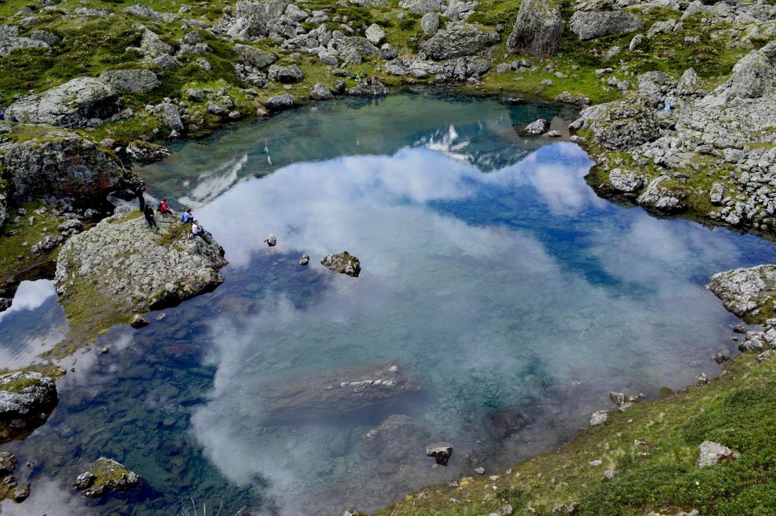
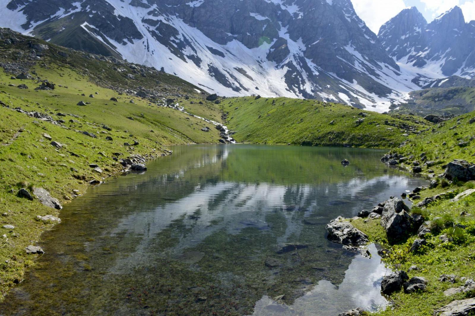
The colorful Abudelauri Lakes are glacial lakes located at the foot of the Caucasus Range, specifically at the base of the Chaukhi Massif, at an altitude of 2600 meters above sea level.
The Abudelauri Lakes are part of the Pshav-Khevsureti National Park. Along the way, you'll encounter the massive Roshka boulders, which are recognized as natural monuments. From Roshka, it's seven kilometers to the Blue and Green Lakes (these two lakes are separated by a small hill), and nine kilometers to the White Lake. The distance becomes shorter if you approach from the Arkhoti roadside.
The Abudelauri Lakes consist of three lakes - the Green Lake, Blue Lake, and White Lake. The Green and Blue lakes are located almost side by side, while the White Lake is situated a bit further away at the foot of the Chaukhi Massif and has relatively more difficult access. The Abudelauri Lakes are 7 kilometers away from the village of Roshka, which is the shortest and easiest trail to visit this place. The best time to visit is June and July.
Shatili
Shatili is recognized as one of the brilliant, unique monuments of Georgian architectural art and is located north of the main Caucasus ridge, at an altitude of 1400 meters above sea level. The village, built on a cliff, served both as a residential area and a fortress, protecting Georgia's northern passes for centuries.
Shatili's main structure is characterized by tightly grouped buildings arranged in tiers according to the terrain. The main elements of the village's construction are flat-roofed fortress houses and tower dwellings.
The fortress-houses and tower complexes range from three to five stories. The row of adjoining fortress houses creates a unified, impregnable defensive wall that securely encloses the village. Shatili is connected to the outside world by a single narrow road through the Arghuni gorge. The buildings are arranged in terraces, with the main types being flat-roofed houses and tower dwellings. Shatili's uniqueness lies in its system of internal passages connecting the fortress towers, allowing movement throughout the complex without going outside. Since 2007, Shatili has been included in UNESCO's World Heritage Sites list.
Mutso
The Mutso complex has no analog and leaves an indelible impression on all visitors with its uniqueness. The fortress village is distinguished by its unique architecture and is located on a high and very steep slope.
Specifically, the fortress-village is located in Pirikita Khevsureti, in the Ardotistskali River gorge, at an altitude of 1800 meters above sea level, atop high cliffs.
From ancient times, Mutso represented a unified fortification and defensive system and was the main point protecting the roads coming into Georgia from the north. In the village, which was abandoned more than a century ago, there are up to forty medieval residential and household buildings.
Arkhoti
Did you know that Arkhoti is the least populated region in Georgia and is connected to the country only by footpaths over mountain passes? It is located in the northern part of Khevsureti, in the Asa River gorge, bordering North Ingushetia. It is connected to Piraketa Khevsureti by footpaths. The main shrine of the Arkhoti community is the Akhieli Michael Archangel's Cross. Only three villages remain in Arkhoti.
Anatori Crypts
Anatori is located in Pirikita Khevsureti, approximately 3 kilometers from Shatili. According to tradition, in the 19th century, the plague ravaged Anatori and almost the entire village became ill. To prevent the spread of the epidemic, locals built crypts away from the village, and whoever felt the disease would walk on their own, lie down in the crypt, and wait for death. Skulls and bones are still preserved in the crypts, which are located east of the abandoned village at a place called Meidani. In the 11th-15th century cemetery, an underground family tomb was excavated, built with broken stones, and covered with sandstone slabs, in which only the bones of the deceased were found. Nearby are several above-ground and semi-underground crypts from the developed Middle Ages. Two vaulted semi-underground crypts were excavated. Inside the crypts, slate shelves are arranged in two or three tiers along the rocks for the deceased to rest. Several dozen people were buried in the crypts. The bones of those buried earlier were accumulated on the floor and under the lower-tier shelves. Wooden vessels, jewelry, arrowheads, coins, and other items were found here.
Roshka
The village of Roshka is located in Piraketa Khevsureti and is one of the oldest settlements in Khevsureti, through which an important internal travel route passed. From the 19th century, mountain population migration began from Roshka to Ertso-Tianeti. According to the 1924 census, the village was home to 137 people, primarily engaged in cattle breeding. Currently, there are only a few permanent families. Didgori Cross - the main community shrine of Roshka-Kmosti is located near the village. The shrine includes a hall, treasury, and workshop. The Archangel's Cross is located on the left bank of the Roshka River, on a high mountain peak. The shrine includes a granary, hall, Mariamtsminda tower, and bell tower.
Lebaiskar Tower
The Lebaiskar Tower is a well-preserved example of the Khevsur towers. It represents a medieval architectural monument and is one of the examples of residential fortress-houses common in Tusheti-Khevsureti, located on the Shatili road near Datvisjvari Pass. It stands in the Arghuni River gorge, near the abandoned village of Lebaiskar, 200 meters from the Barisakho-Shatili motorway. It belongs to the late Middle Ages. The tower is square in plan, five stories high, built with broken stone. The entrance is on the east side, on the second floor, 2.2 meters above the ground.
Pshav-Khevsureti National Park
Pshav-Khevsureti National Park is located in Dusheti Municipality, in Pshav-Khevsureti, on the northern and southern slopes of the Caucasus Range. Its unique nature and location inspire visitors. Many historical and cultural monuments are found in this region of Georgia. Pshav-Khevsureti is one of the most popular tourist regions in Georgia, with unique traditions and cuisine.
Pshav-Khevsureti National Park encompasses the valleys of the rivers: Asa, Arghuni, Andakistskali, and Pshavi Aragvi.
Currently, several types of tourism are prevalent in Pshav-Khevsureti:
- Auto tours
- Hiking tours
- Horseback riding tours
- Cultural tours
- Adventure tours
Gudani
Gudani is a village in Khevsureti, located in the Dusheti Municipality of the Mtskheta-Mtianeti region. According to old traditions, the village of Gudani is considered the primary settlement of "Khevsureti." The original Khevsur surnames were Chincharauli, Arabuli, and Gogochuri, while other surnames come from mountaineers of various origins. Additionally, there is the significant Gudani Cross here - a deity and its shrine. In Khevsur's praise texts, it is mentioned by the name of the divine monk Baaduri. The entire Gudani Cross was considered the cultural center of Khevsureti, and common affairs were discussed and decided here.
Village of Ardoti
Ardoti is an interesting village located in the territory adjacent to Mutso. It has interesting towers, and a church has also been preserved. The village of Ardoti is a modern village whose lower district is founded on an old abandoned village site. It is located on the left side of Andaki's water, where the Biso Gorge joins the Aragvi.
Reaching Ardoti is difficult except from the southern side. Ruins of rectangular fortress-houses are preserved here. In the southern part of the village stands a small church with a gabled drainage roof. On the southern side, where the village entrance is, until the 1980s, there was a five-story tower with a drainage roof erected on the rocky slope.
Location
Khevsureti is divided into two parts - Pirikita and Piraketa Khevsureti, separated by the main Caucasus ridge. Apparently, from the period of Christianity's spread in Georgia until the Middle Ages, Khevsureti, together with Pshavi, was referred to as Pkhovi. Pirikita Khevsureti consists of the Ardoti, Shatili, and Arkhoti gorges, while Piraketa Khevsureti comprises the Aragvi gorge. The center of Piraketa Khevsureti is Barisakho, while Shatili is the center of Pirikita. Khevsureti is bordered by Chechnya and Tusheti to the east, Khevi and Mtiuleti to the west, Kisteti to the north, and Pshavi to the south.
You can reach Khevsureti through several routes: from Tusheti to Khevsureti via Atsunta Pass, from Gudamakari to Khevsureti via Pkhituri Pass, and from Pshavi to Khevsureti.


Please login to add a comment
Write a comment